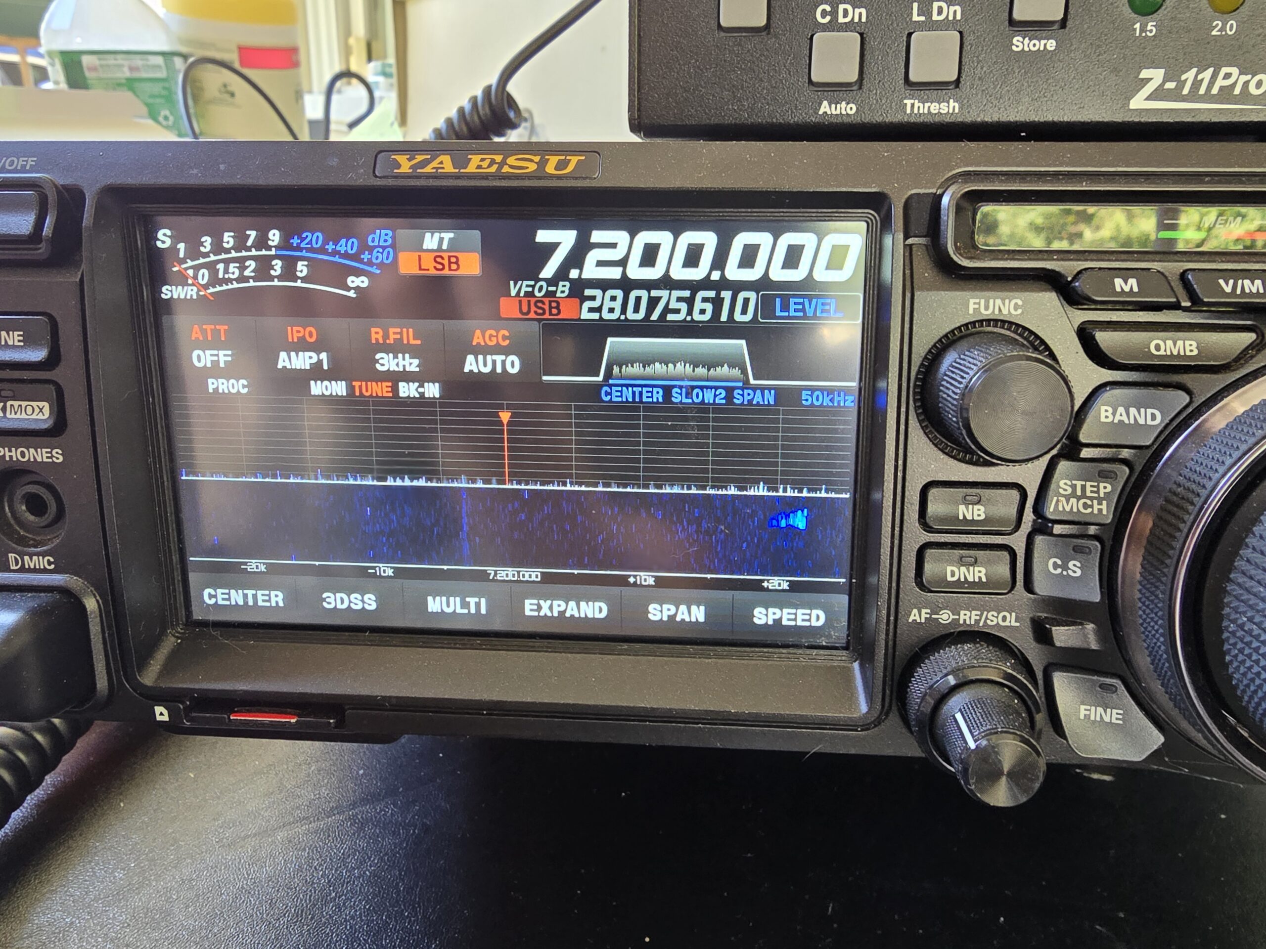
Welcome to December. Hi From K1FRC in Connecticut!
K1FRC Station Update – 12.02.24
Weather Headlines
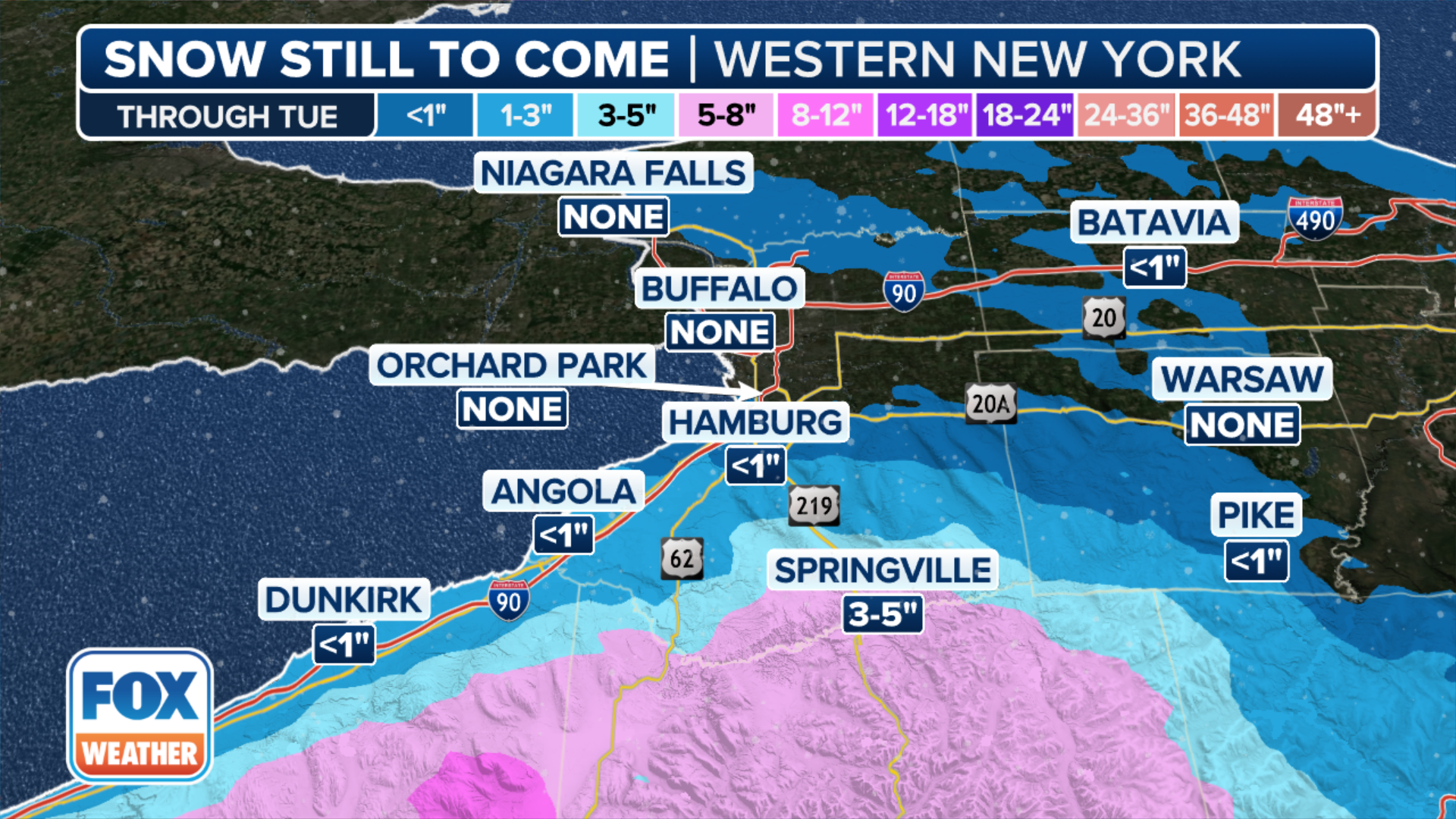
Heavy Lake Affect snowsqualls continue falling in portions of Western and Central New York State with total storm totals approaching 4 to 5 feet in the most persistent bands of precipitation. There will be a lull in the Lake Effect snow machine tomorrow night as a clipper system passes through the mid-Atlantic into the northeast, however, heavy snow bands off the lakes will resume after that system’s passage.
Tonight’s weather map valid through Tuesday 12 Noon Eastern:
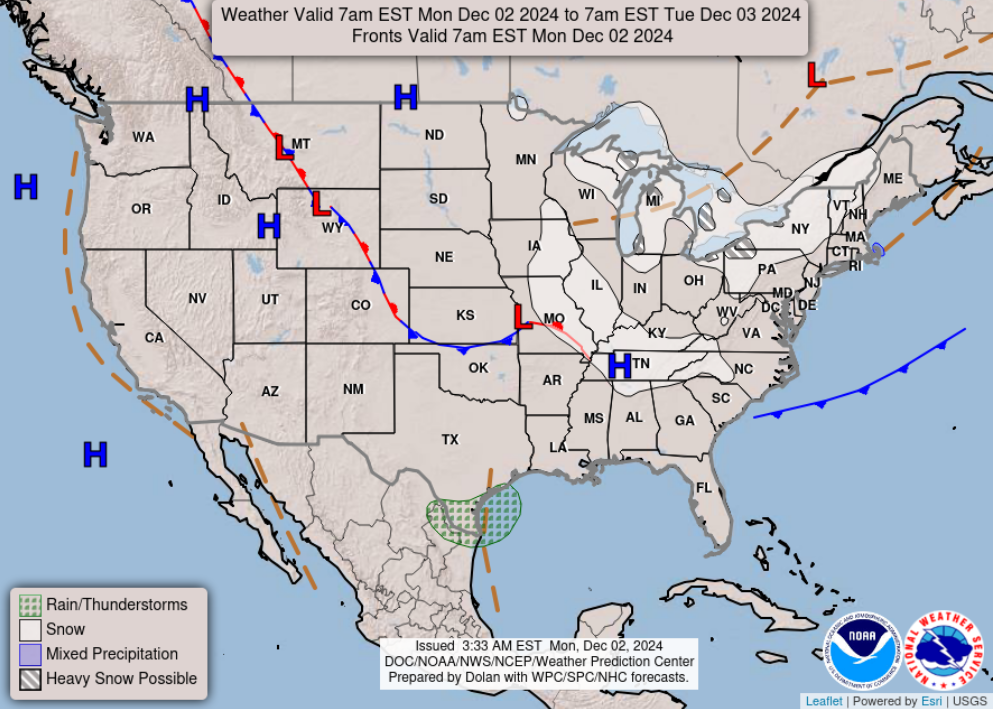
Elsewhere, the west will continue experiencing much above-average temperatures, as the jet stream continues to flow far north of the Canadian border, but a significant dip in the arctic flow east of the Rockies will keep the Eastern US and Canada frigid for this time of year, with well-below normal temperatures expected through the upcoming weekend. Light frozen precipitation is expected from Eastern Iowa through western North Carolina, and the Great Lakes region from for northeastern Ohio, up the I90 corridor though Northwestern PA and into Western New York State. Most of this precipitation is in the form of snow, which will be heavy at times, and in bands. Portions of Northern New England (Mainly Western Massachusetts, Central and Northern Vermont, NH and Maine) will see some light snow activity beginning Tuesday evening and lingering into Wednesday. Some light accumulations in the 1 to 3 inch range can be expected. Areas to the south and east will see mainly rain, or a mixture of rain and snow, with little or no accumulation through Wednesday evening.
-West
Data courtesy of NOAA/National Weather Service (US)
–Hi everyone!
I hope everyone had a great Thanksgiving! As for me and my XYL, we had the best Thanksgiving we could have. No stress, a nice quiet turkey dinner with my stepdaughter Rebecca and my grandson Carter. Hearing my wife tell me that it was beautiful and she was not stressed at all was music to my ears!
Getting back to DX… we had two decent 6 meter openings since last Friday, and 10 meters has been ROARING! My best contact over the weekend was with G3YPZ, John in Spaulding in the UK. He was running 70 watts AM using an early 1970s vintage Heathkit on 29.080 mHz. Loudest signal on the AM portion of 10 meters. That particular Saturday morning, I also had a rather lengthy QSO on 29.615 FM with KE0KKD, who stood out because he QSYd to that frequency from the 29.600 FM calling frequency. Once he moved, he stood right out on the waterfall.
If you look at my log on QRZ.com, you’ll notice that I’m back to doing some FT8. FT8, FT4 and so on actually rather bores me these days, however, I enjoy the challenge of 10 meter AM and FM. While the FM portion of 10 meters gets a decent amount of activity, the AM portion of the band is significantly less, technically it’s 28.900 to 29.100, but you’ll find most of the activity in that one MHZ slice from 29.0 to 29.1. Sometimes, if you’re lucky, two or more AM signals will show up on the waterfall at the same time… which this past weekend happened quite a bit. Usually, however, you have to just set your transceiver to 29.000, set your receive bandwidth to 1 mhz and just wait for a signal to show up. It’s a waiting game, even though at the same time, the SSB portion of 10 set aside for Technician class operators (in the US) is over crowded with overlapping signals and so on. I guarantee you, if you’re looking for action and a thrill on HF right now as we approach the tippy top of solar cycle 25, it’s on 10 meters no matter what mode you want to operate! Even CW!
I’ll be updating more often now that we’re mostly moved in at our new address. Remember, my QTH is the city of NAUGATUCK, CT, USA. Grid square FN31lk. Till we meet on the air again… 73!
